Let it snow … briefly
Published 10:26 am Tuesday, November 13, 2012

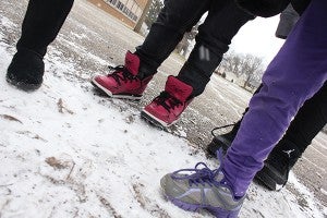
First-grader Anjel Teran Caballero finds a piece of ice on a cold Monday at the playground at Neveln Elementary in Austin. Flurries briefly blanketed the area; however, temperatures may remain in the 40s throughout the rest of the week. -- Matt Peterson/matt.peterson@austindailyherald.com
Area sees its first dose of winter weather
Old Man Winter made a brief appearance throughout the region, but did not stay.
According to the National Weather Service in La Crosse, Wis., the Austin area received only trace amounts of snow Monday. Meteorologist Dave Schmitt said it was too little to measure.
“Just enough to maybe collect on the curbs and in the cracks of the sidewalks,” he said. The snow was so light that any accumulation quickly melted later in the day.
The Monday high was a mere 27 degrees, which is about 20 degrees cooler than the typical temperature at this point in the year. Schmitt called it a “reality check” after Saturday’s high of 73, and noted it was a “precursor of what’s to come.”
Daytime highs are forecasted in the 40s for the rest of the week. While some upper-level atmospheric systems will produce clouds, no snow or storms are on the horizon.
“It looks like we’re kind of in a dry, warm period at least through the weekend,” Schmitt said.
Meteorologist Andrew Just said Monday the snowfall would not cause any snowpack, which helps the temperatures remain warmer. West of Minnesota, several states, including portions of Montana, Wyoming and the Dakotas, already have a snowpack and have dipped to nighttime lows below zero. Monday morning, Williston, N.D., was 6 below.
Still, the rest of the week should bring about average temperatures, with conditions anywhere from partly cloudy to mostly sunny — what Just calls “benign.”


