Area placed in flood watch through Friday
Published 7:57 am Wednesday, March 13, 2019
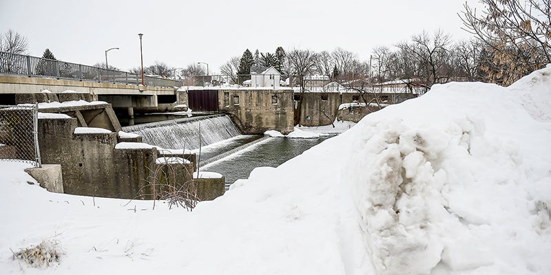
- Snow mounds flank the Cedar River Tuesday morning in downtown Austin. Those mounds of snow could create a problem Wednesday and Thursday when temperatures climb into the 40s. The area will be under a flood watch Wednesday into Thursday. Eric Johnson/photodesk@austindailyherald.com
We’re getting the warm-up we’ve been hoping for, but along with that comes the potential for flooding.
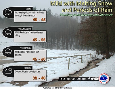
Photo courtesy of the National Weather Service
According to the National Weather Service, Austin is now in a flood watch from Wednesday morning through Friday morning at 7 a.m.
Snow melt from rising temps that will reach into the 40s, along with predicted rainfall Wednesday and Thursday, will cause most streams and rivers to rise. How much remains uncertain at this point and a risk of ice jams could compound these threats.
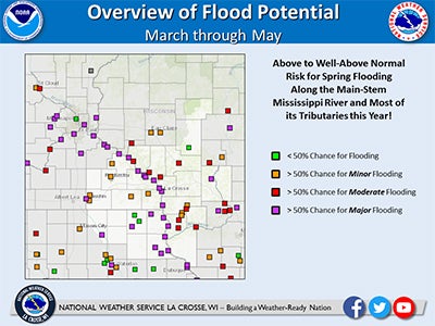
Photo courtesy of the National Weather Service
The watch itself extends across southeast Minnesota and northeast Iowa along with portions of the southwest Wisconsin.
Some spots could see over an inch of rainfall by the time the system moves through. Thursday night there is even a chance of wintery mix.