Storm’s second act could bring 10 inches of extra snow
Published 8:40 am Wednesday, February 22, 2023
|
Getting your Trinity Audio player ready...
|
Winds expected to pick up, cause blizzard conditions
As this week’s system continues slogging through the state, the area now waits for the other shoe to fall later today.
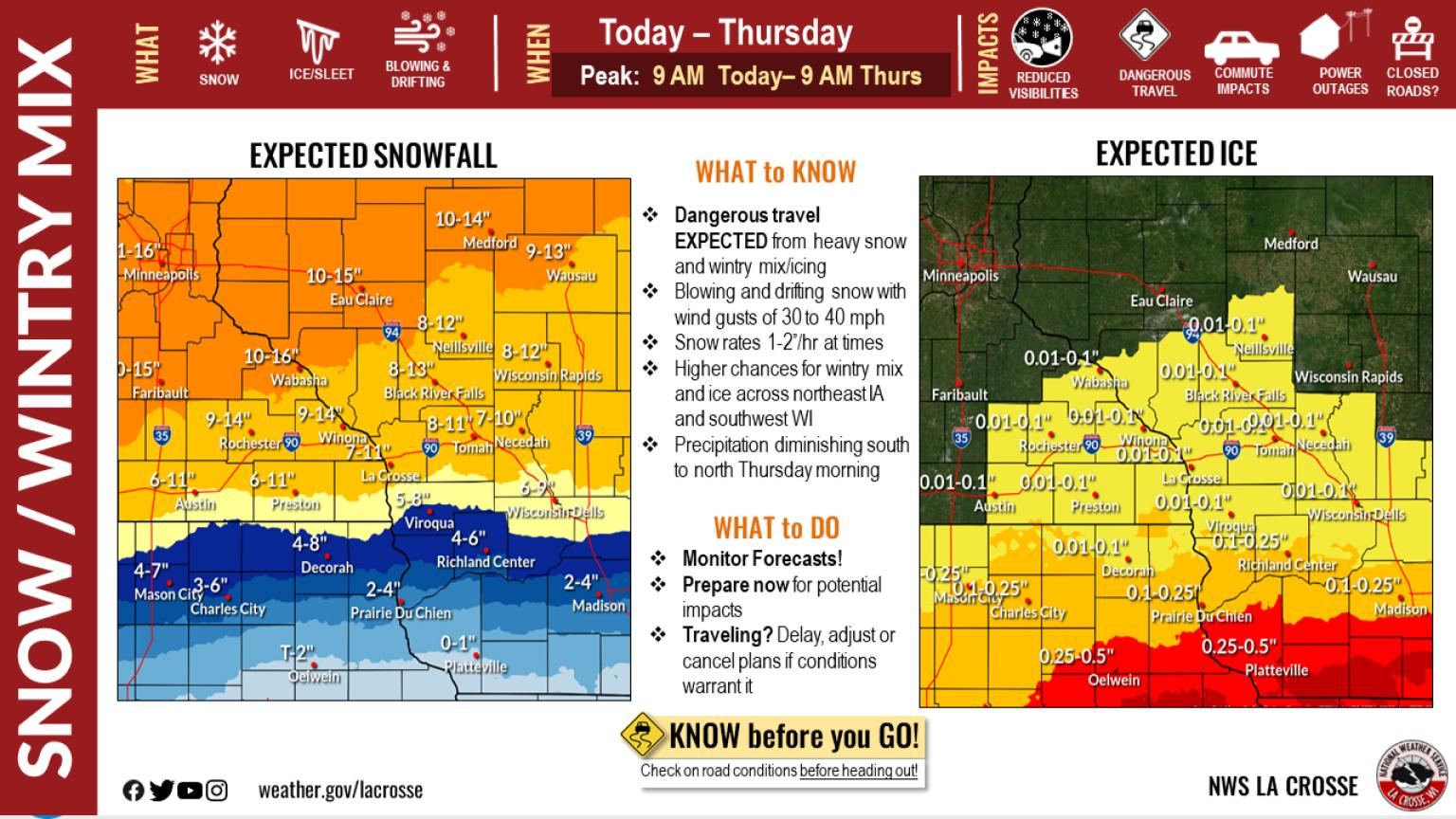
The first round didn’t turn out to be quite as impactful with 3-4 inches of newly fallen snow Tuesday. However, according to the National Weather Service, this second round is slated to bring a possible 6-10 inches through the day and into the night.
This second part of the snow also has the possibility of producing a wintery mix along with increased winds and gusts as high as 39 mph possible.
The area remains under a winter storm warning through noon on Thursday.
Courtesy of the National Weather Service
Snow is expected to fall before 4 p.m. and then possibly switching to a mix of snow and sleet between 4-5 p.m.
After 5 p.m., widespread blowing snow is expected to spread through the region. The high winds along with possible ice could create power outages.
The snowfall could be historic, even in a region accustomed to heavy snow. As much as 25 inches may pile up, with the heaviest amounts falling across east-central Minnesota and west-central Wisconsin, the National Weather Service said. Wind gusts could reach 50 mph and wind chills are expected to hit minus 50 degrees Fahrenheit (minus 46 degrees Celsius) in some parts of the Dakotas and Minnesota.
The Minneapolis-St. Paul area could see 2 feet (61 centimeters) of snow or more for the first time in over 30 years.
Wind gusts may reach 50 mph in western and central Minnesota, resulting in “significant blowing and drifting snow with whiteout conditions in open areas,” the weather service said.
— The Associated Press contributed to this story