CRWD projects included in bonding bill
Published 8:08 am Tuesday, October 27, 2020
|
Getting your Trinity Audio player ready...
|
More state funding is coming next year for the Cedar River Watershed District to continue building structures that temporarily hold stormwater in upland, rural areas of Mower County.
On Wednesday, Gov. Tim Walz signed the largest bonding bill in state history at $1.9 billion in public infrastructure projects. That capital-investment bill includes funding for CRWD projects as part of $17 million for the Minnesota Department of Natural Resources’ (DNR) flood-hazard mitigation program.
Out of those funds – which are lower than the originally proposed $20 million – CRWD could receive about 75 percent of its original request of $500,000 in state funds for projects that reduce flooding and improve water quality. The specific funding amount for CRWD will be determined in the coming months by DNR flood-mitigation staff.
CRWD Administrator Justin Hanson said the bonding bill’s passage – which had not happened in several previous special sessions this year following the Legislature’s regular session ending in May – is a relief because it ensures projects can happen in 2021 for the district’s Capital Improvement Plan (CIP) to build upland-storage projects.
“This funding will allow us to keep momentum going with our continuing progress in making the Cedar River State Water Trail a healthier waterway,” Hanson said, adding it also helps as leverage when CRWD seeks additional funding for CIP work.
Hanson thanked local legislators Rep. Jeanne Poppe and Sen. Dan Sparks for their continuing support and work at the Legislature to help secure state funding for the watershed’s projects.
Another $100,000 in other state funding for CIP projects is planned for 2021-2022 under the first budget for the Cedar-Wapsipinicon Comprehensive Water-Management Plan as part of the “One Watershed, One Plan” funding from the Minnesota Board of Water & Soil Resources (BWSR).
“We have set aggressive flood-storage goals, and it’s exciting to see real progress happening toward this complex issue,” Hanson said. “With every project, the Cedar River watershed is becoming more resilient to flooding, and we just hope to be able keep this vital work going each year.”
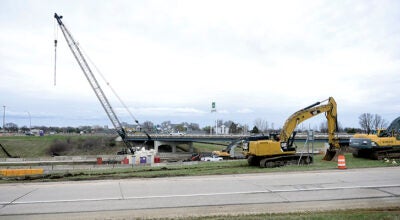
To date, CRWD has surpassed its original goal of 8 percent by achieving at least a 10-percent peak flow reduction at the Cedar-Dobbins confluence in Austin in the past five years now that construction finished this summer on creating the district’s biggest project to date – Dexter 30-Dam 2. Spanning nearly 2,000 feet long with a 21-foot peak berm height, the $1.2 million structure is fully functional for temporary stormwater storage in the headwaters of Dobbins Creek’s south branch.
CRWD’s goal for its CIP initiative was achieved with a $3.2 million grant from The Hormel Foundation and another $3.4 million in state and local funding that built 14 projects, including 11 upland-storage structures in the Dobbins watershed. These projects mostly were built on streams flowing into the creek’s north and south branches.
Nearly 3,000 acres of mostly cropland now are controlled by CIP projects in the Dobbins watershed prone to flash flooding. With all CIP projects in place, a 10-year rain storm (roughly 4 inches of rain) – which leads to some rural roads being overtopped by flooding – would be about one foot lower at its peak downstream from Dobbins Creek’s confluence of its north and south branches in the Jay C. Hormel Nature Center.
CRWD heavily targets the Dobbins watershed due to its history of flash flooding that causes water-quality issues and flood damage to rural and urban infrastructure and properties. Upland water storage is a CIP focus because it decreases the amount and speed of stormwater flow, reducing the potential for significant streambank erosion.
Through the CIP projects’ treatment, much of the sediment, excess nutrients and other pollutants in stormwater can settle to the bottom of the basin created behind the berms rather than continue into Dobbins Creek and the Cedar River.