Area gearing up for 1-2 punch
Published 6:45 am Thursday, January 16, 2020
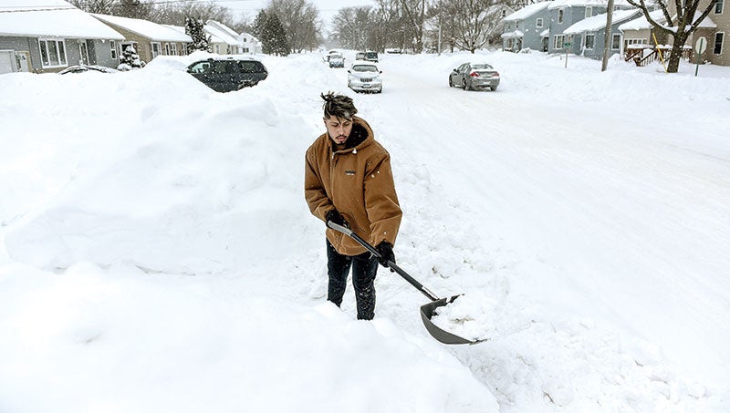
- Herald file photo
First comes the cold and then comes the snow.
As the area braces for significant snowfall on Friday, we will first have to get through the cold currently gripping us. After a high in the mid 20s on Wednesday, temperatures began dropping significantly in the overnight hours into today, holding at around -7 through the day according to the National Weather Service. Wind chill values will dip even lower, making it feel around -23.
Friday is when the snow will come with a possible 3 to 5 inches predicted, driven by winds of 13 to 22 mph and gusts of close to 38 mph.
Snow will kick back up before 9 p.m. with new snow accumulation of 2 to 4 inches possible on top of a possible mix of snow and freezing rain late Friday between 9-11 p.m. and then turning to all snow after 3 a.m.
It will likely snow up to noon on Saturday, bringing with it the possibility of a half inch of snow with winds again whipping up to 23 to 28 mph in the afternoon.
Temperatures will continue to remain on the cold side of things through the rest of the week with lows dipping to between -6 and -9 through the weekend.
On Wednesday the area was placed under a winter storm watch from 6 p.m. Friday through 6 p.m. Saturday.
Make the best of the snow. Austin Living is looking for winter scene photos. Send them to photodesk@austindailyherald.com