Snow amounts still pending as system bears down on area
Published 12:23 pm Friday, March 8, 2019
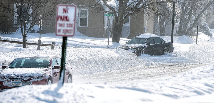
- A cars sits buried in an intersection in northwest Austin in February afternoon. The area is once again looking to get substantial snow with this new system. Herald file photo
While the possibility for significant snowfall is very much on the bill for Saturday and Sunday, just how much is still hard to nail down.
According to the National Weather Service, Austin and southeast Minnesota sits right on the line currently ,with heavier amounts of six to eight inches predicted closer to the Twin Cities and our area siting in the four to six inch range.

This animation shows Saturday’s storm as it begins working its way into the area. Courtesy of the National Weather Service
However, the NWS is hinting that band could still shift to the south bringing with it those heavier amounts.
What continues to further complicate this system is the mixed precipitation and high winds accompanying the storm.
As of early this afternoon, the NWS a mix of rain, snow and freezing rain is expected to enter our area before 2 p.m. on Saturday, followed by rain and snow and then snow after 4 p.m. The winds are expected to be between 11 to 21 miles per hour with gusts of 33 miles per hour expected.
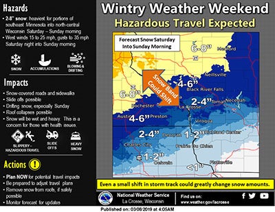
Current layout for this weekends winter storm. Photo courtesy of the National Weather Service
Should this system stay on track, three to five inches of snow are expected Saturday with an addition one to two possible Saturday night.
On Sunday, wind will tend to be the biggest problem as winds will peak between 17 to 23 miles per hour with gusts of 36 miles per hour expected.
The storm has already made its presence felt. The Austin Packers boys basketball team was supposed to play Red Wing at 1 p.m. in the Section 1AAA Tournament Saturday, but that game was postponed to Saturday at 6 p.m.