‘Welcome winter’ Storm may dump 6 inches on area, then brrrrr!
Published 10:06 am Friday, December 9, 2016
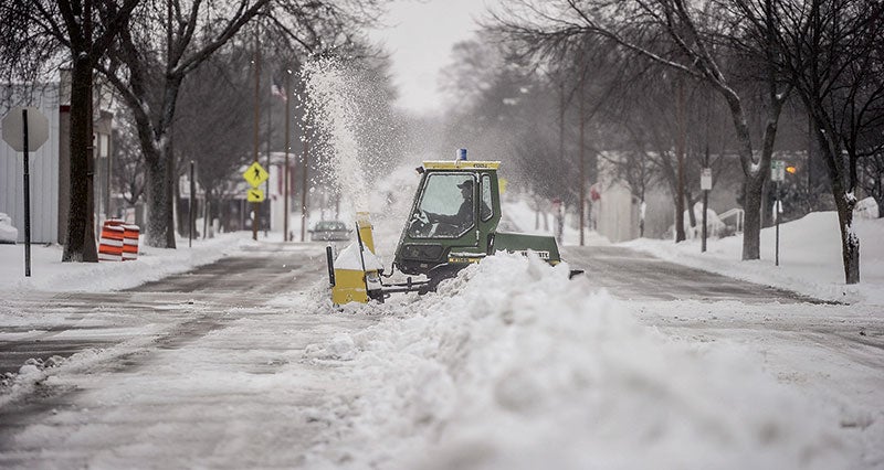
- A snowblower clears a path through the gathered snow in the middle of Second Street NE last year. Herald file photo.
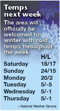
-National Weather Service
Get ready: Austin should experience its first large snow event of the season tomorrow.
According to the National Weather Service in LaCrosse, Wisconsin, Austin sits smack dab in the middle of a snow band that could dump up to 6 inches of the white stuff by the time the storm passes on Sunday.
“Welcome winter,” agreed meteorologist Peter Rogers, adding that the forecast shows 80-100 percent certainty.
Saturday morning should be dry with snow beginning sometime after the noon hour. Up to two inches could fall by 6 p.m., with another three to four inches falling overnight and into Sunday.
Winds could blow a bit of the stuff around, at 5-10 mph through most of the event. The storm should pass by Sunday afternoon, with lingering light snow possible. Highs on Saturday and Sunday should hover around 20 degrees. Lows on Saturday night will only dip a few degrees, to about 17.
The second part of the story could come on Tuesday when the area will be plunged into the icebox.
“Monday will be the only so-called ‘warm’ day of the week,” said Rogers, when highs will be about 20 degrees above zero.
Then, it all changes, when the Big Chill begins Monday overnight and into Tuesday, when the low of 3 degrees will only rise to 5 degrees above zero during the day.
The week will only get colder, as lows will dip to 5 degrees below zero Tuesday night. With 10-15 mph winds, wind chills could dip to as low as 20 degrees below zero. Highs on Wednesday, Thursday and Friday are only expected to reach 4 to 5 degrees above zero. Lows will dip to zero or just below zero, all three of those nights.