Rain drenches area; Austin gets 1-2 inches, Brownsdale 4.5
Published 10:45 am Thursday, June 18, 2015
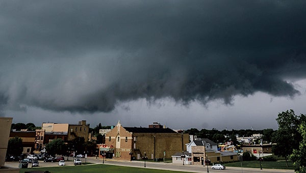
Storm clouds tower over the Paramount Theatre as they roll over downtown Wednesday afternoon. Eric Johnson/photodesk@austindailyherald.com
A storm system brought menacing clouds, heavy rains and minor flooding to Mower County late Wednesday afternoon.
The Austin area got between 1 and 2 inches Wednesday according to the National Weather Service, while residents south of Brownsdale received as much as 4.5 inches.
“It was just a very quick, unpredicted storm that came through,” Mower County Emergency Management Director Amy Lammey said.
The storm passed through parts of Mower, Steele and Freeborn counties and left parts of Mower and Freeborn with flood warnings and watches overnight — all of which had expired by Thursday morning as water levels started quickly receding.
“They rose and then they went back down right away,” Lammey said.
NWS readings showed Turtle Creek waters rising to 7.56 feet near Austin by 7:30 a.m. Wednesday, which classified as the flood action stage but was below the moderate flood stage of 10.5 to 11.9 feet.
The Cedar River dropped to 11.6 feet by 7:30 a.m. in Lansing after peaking overnight at just under 12 feet, well below the action flood stage of 14 feet, according to NWS readings. At 7 a.m., the Cedar was at 8.9 feet in Austin, where the flood action stage is 12 feet.
Thursday and Friday look to dry out with highs in the upper 70s, but there is another chance for rain early Saturday morning, and meteorologists say storms are likely from there through Saturday afternoon.
Several forecasters are calling for humid conditions on Saturday, and it looks like that trend could continue into next week with high humidity and highs in the 80s.